Advanced LTPBR Planning
Build a useful understanding of a riverscape, refine it as far as necessary, and turn it into a clear, defensible plan for action. In this advanced short course, participants use Riverscapes Studio (QRiS) to complete a site-scale LTPBR planning analysis for one or more potential restoration projects within a riverscape of their choosing. They assess current riverscape health, estimate relevant historical conditions, and evaluate realistic potential future conditions to prepare for LTPBR design.
Online · September 28 – October 1, 2026 · 1 graduate credit or 1.5 CEUs

Take me to Canvas
I'm enrolled. Take me right to 2026 Canvas Course (Requires registration).

Take me to Lectures & Modules
The modules associated with WATS/CEWA 6626 - Advanced LTPBR Planning are free for viewing here.
Registration Open
- Professionals register through USU Continuing Education - Open until day before!
- Matriculated USU Students - Register via Banner
Course Information
| Course Number | Format | Dates & Days | Times | Credit | Cost |
|---|---|---|---|---|---|
| WATS/CEWA 6626 | Live Online  | Sep 28 – Oct 1, 2026 · Mon, Tue, Wed, Thu | 9:00 am - 12:00 noon; 2:00 to 4:00 pm MT | 1 Graduate Credit · 1.5 CEUs | Standard Tuition or $330 for CEU |
Who Should Attend
This advanced short course is designed for restoration practitioners, natural-resource professionals, graduate students, and GIS users who want to move from general LTPBR concepts to a defensible site-scale planning analysis. Participants should bring a real or realistic project site to work on throughout the course.
Prerequisites
- Be comfortable with basic GIS workflows. See Getting Oriented in QGIS for self-paced preparation or USU's Geospatial Collective for formal training options.
- Be familiar with the planning concepts in Chapter 3 of the LTPBR Design Manual. Previous completion of WATS/CEWA 5622 is helpful but not required.
- Install a supported version of QGIS and the Riverscapes Studio (QRiS) and Riverscapes Viewer plugins before class. See help session below.
- Have a Riverscapes Consortium account and arrive with a candidate project site. Existing WATS/CEWA 5622 projects may be reused and expanded.
We are offerring an optional help session if you have trouble installing QGIS or QRiS. Topic: Optional QGIS/QRiS Install Help Session Time: Sep 25, 2026 11:00 AM Mountain Time Join Zoom Meeting
Instruction Team





Office Hours - For every day class meets, we will hold office hours from 13:00-14:00 MST on the Zoom link for class. Or by appointment.
Course Overview
Planning rarely begins with complete information or a perfectly defined problem. It begins with a place, a problem (sometimes ill-defined), what is already known, and a set of consequential but provisional judgments.
This course helps practitioners turn that initially messy situation into a defensible plan for action. Participants will assemble available information, develop an early interpretation of how their riverscape works and why it is in its present condition, and then challenge and refine that interpretation with evidence appropriate to the decisions at hand. They will use that understanding to make transparent judgments about objectives, recovery potential, risks, opportunities, constraints, and spatial priorities.
The goal is not to complete every possible analysis before making a decision. It is to make useful planning judgments early, document the evidence and assumptions behind them, and improve them iteratively. The resulting planning analysis should be sufficient to guide the next stage of project design while remaining open to learning and adjustment.
Relationship to the Advanced LTPBR Series
WATS/CEWA 6626 concentrates on the planning work that precedes detailed treatment design. It carries a project from an initial problem and project area to a defensible understanding of the riverscape and a clear planning handoff: objectives, recovery space, spatial priorities, likely treatment approaches, risks, constraints, all of which help constrain subsequent design decisions.
That handoff becomes the starting point for WATS/CEWA 6627 — Advanced LTPBR Design.
Learning Outcomes
By the end of this course, students will be able to:
- Frame a planning problem by clearly stating the project purpose, management goals, initial problems and opportunities, project area, and broader watershed context.
- Assemble and organize existing knowledge—including spatial data, model outputs, imagery, observations, and stakeholder information—in a Riverscapes Studio project.
- Read and interpret a riverscape by developing an early explanation of how it functions and why it is in its present condition.
- Refine that understanding with appropriate evidence by mapping and comparing current, estimated historic or reference, and realistically attainable future conditions.
- Make transparent planning decisions about project objectives, recovery potential, risks, constraints, opportunities, and spatial priorities while explicitly documenting assumptions and uncertainty.
- Evaluate the appropriateness and likely role of LTPBR within the site's broader recovery trajectory.
- Prepare a defensible handoff to design that identifies objectives, likely treatment approaches, design considerations, expected outcomes, and questions still requiring resolution.
- Communicate and share the planning analysis through a concise report, presentation, published Riverscapes Studio project, and, where appropriate, a proposed project entry in PBR Explorer.
Main Course Project
Each participant will complete an LTPBR Planning Analysis for a project reach or riverscape of their choosing. Participants may continue a project begun in WATS/CEWA 5622 or select a new site.
The project will develop iteratively throughout the week:
- First pass: Define the project area and purpose, assemble readily available information, and produce a broad initial interpretation of the riverscape, its problems, and its opportunities.
- Refinement: Add mapping, observations, analyses, and other evidence where they meaningfully test or improve the initial interpretation.
- Planning decisions: Translate the refined understanding into explicit objectives, recovery potential, spatial priorities, risks, constraints, likely treatment approaches.
- Design handoff: Organize the analysis so that it can directly inform detailed LTPBR design and future adaptive management.
In class exercises will be a mix of guided examples where we all work at the same site, and students applying the same methods on their own sites.
Final Products
To complete the course, participants will:
- Complete the planning portion of an LTPBR Planning Report, including supporting maps, analyses, assumptions, and planning decisions.
- Create a QRiS project, and publish it to the Riverscapes Data Exchange.
- Attach their completed planning report as a PDF attatchment to the published Riverscapes Studio project, and associate it with their planning DCE(s).
- Create a proposed-work entry in PBR Explorer when appropriate. Projects may be kept private within a Data Exchange organization shared with the instructors.
- Give a concise presentation of the project and receive peer and instructor feedback at end of workshop.
- Share links to the presentation and Riverscapes Studio project in the Advanced LTPBR Series Community.
Course Resources
The course will use:

Main Course Resources Page
The main page for course materials and resources is on the QRiS Webiste.
QRiS & QGIS
Riverscapes Studio plugin to QGIS will be the software used in this course.
Chapter 3 LT-PBR Manual
Chapter 3 of LTPBR Design Manual is on Planning

Module 3 Self-Paced Modules
Content from WATS/CEWA 5622 Module 3 on Planning
Canvas
Course Page for Assignment Submission, Zoom and Grades
We will be using Canvas for this class. Communication outside of class time will be on our Advanced LTPBR Series Community on the Riverscapes Consortium. Assignments will be submitted officially in Canvas and by sharing your Riverscapes Studio Projects on the Data Excahnge and as posts in our community.
Community Resources
These communities from the Riverscapes Consortium are great places to ask questions, connect with colleagues and share your work. These communities extend beyond just the one week class.
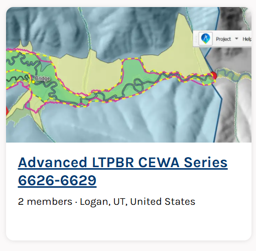

Advanced CEWA LTPBR Series Community
The community for connecting with others in this class and the advanced series of Adavanced LTPBR courses. This is in lieu of Canvas.
Riverscapes Studio Users
Community of QRiS Users. Stay up to date on latest releases, webinars, trainings, ask questions and share your work.

LTPBR of Riverscapes - Practitioner Community
This community is intended to facilitate exchange between practitioners of LTPBR anywhere in the world.
Textbook
LT-PBR Manual
The 2019 Low-Tech Process-Based Restoration of Riverscapes Design Manual (Free/Required). Focus on Chapter 3 of the Design Manual.
Pocket Guide
A LTPBR Pocket Guide to take with you into the field (Optional)
Course Grading
Pass / Fail Grading based on completion of project assignment and participation.
A passing project does not need to represent a final or perfect understanding of the site. Nor does it need to be a real project that will get built. It needs to be what could be a real project (even if assumptions are imagined for this class). It must demonstrate that the student has:
- Developed and subsequently refined an explicit interpretation of the riverscape.
- Used appropriate evidence to support, challenge, or revise that interpretation.
- Made transparent planning decisions and distinguished evidence from assumptions and uncertainty.
- Connected project objectives and recovery potential to the proposed direction for design.
- Identified expected outcomes and important questions for continued learning.
- Completed and shared the required report, Riverscapes Studio project, presentation, and associated links.
Simple: do the work - pass.
University Policies
See Canvas